INFORM

Timber Ridge
Located in Springbank Hill, Timber Ridge is a new, planned community that builds upon the strengths of one of Calgary’s most sought-after neighbourhoods. The vision for Timber Ridge expands housing choice, improves connectivity, and introduces new schools, parks, amenities, and infrastructure to support the area’s continued growth.
Guided by Truman’s commitment to creating exceptional places where people can Live Better®, Timber Ridge reflects a balanced approach to community building that integrates thoughtful design, livability, and long-term value.

Site Details
Address: 3333 & 3421 85 ST SW; 8717, 8775, 8909, 9189, 9190 34 AV SW; and 9250 Lower Springbank RD SW
Total Area: 131.0 acres (53.0 hectares)
Road Closure Area: 2.8 acres (1.1 hectares)
Municipality: Calgary
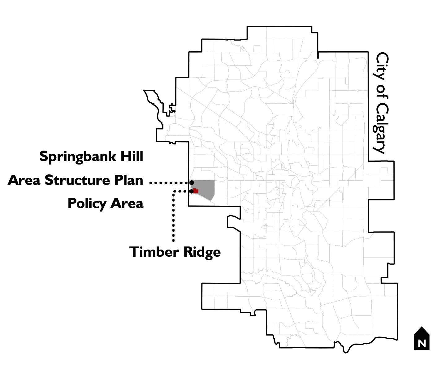
Community: Springbank Hill
Ward: 6
Application Overview
Truman has submitted a comprehensive application for an Outline Plan, a Land Use Redesignation (Rezoning), a Policy Amendment to the Springbank Hill Area Structure Plan, and a Road Closure to facilitate the development of a new, master-planned community in Springbank Hill.
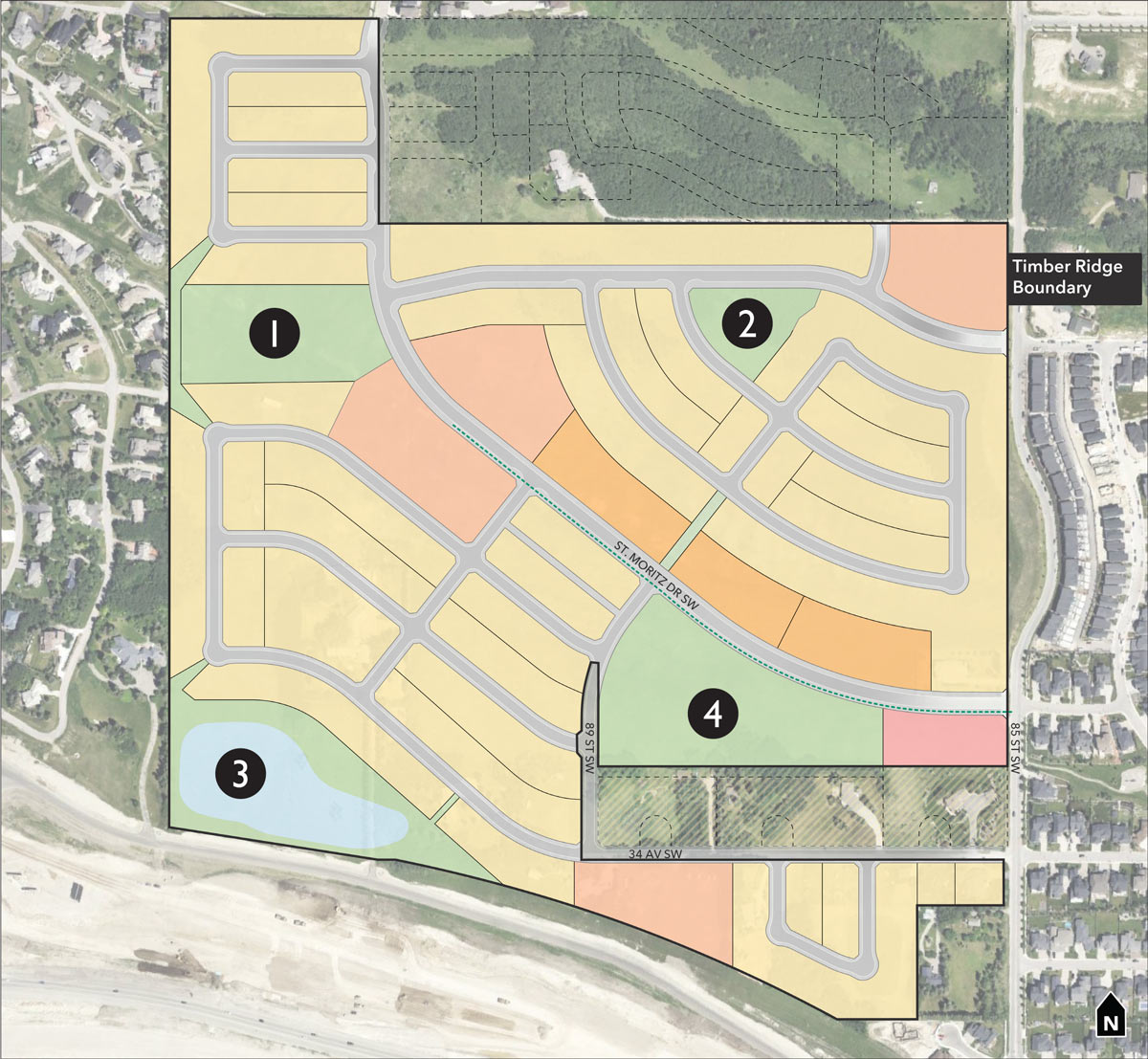
The Outline Plan establishes the long-term vision for the community, which includes:
- A diverse mix of housing options
- An integrated network of parks, pathways, and open spaces
- A new public elementary school site
- A neighbourhood-scale commercial area providing local shops and services
Proposed Outline Plan
Timber Ridge is envisioned as a complete community that offers a diverse mix of housing options, ranging from single-detached homes to multi-family homes, complemented by a neighbourhood-scale commercial area and a comprehensive network of community amenities.
The plan incorporates best practices in community design, with an integrated transportation network, functional parks and open spaces, future school sites, and slope adaptive development that responds to the site’s natural topography.
Together, these elements will support residents of different ages, incomes, and lifestyles while providing both current and future Springbank Hill residents with convenient access to housing, services, recreation opportunities, and everyday needs.
- R-G District: Single-Detached and Semi-Detached Homes
- R-Gm District: Street Towns
- M-G District: Townhomes
- M-2 District: Multi-Family Homes
- C-N2 District: Local Neighbourhood Commercial Node
- S-SPR District: School and Parks
- S-CRI District: Storm Pond, Utilities, and Infrastructure


Design Evolution
Since December 2024, the plan has been refined through ongoing review by The City of Calgary and community member feedback. The revised proposal features a lower overall density, improve local services and infrastructure, and a development pattern that better suits the surrounding area. These changes help support Springbank Hill’s long-term growth while creating a more connected and integrated community.

What Has Changed?
- Less overall density, with a maximum of 1,124 units (reduced from 1,997 units)
- More single-detached and semi-detached homes, particularly next to existing communities
- Less intensity by removing Mixed-Use General (MU-1) land uses and replacing them with lower-density residential and commercial uses
- Less building height with the removal of previously proposed 6-storey buildings along 85 Street SW in favour of lower-scale development
- More local shops and services with the addition of a neighbourhood commercial area
- Less traffic generated by the lower density plan, with available capacity confirmed on the existing and planned road network
- Better road connectivity through the extension of St. Moritz Drive SW to 85 Street SW
- Expanded regional pathways through the extension of the 3.0m multi-use pathway network
- Improved pedestrian safety with a new 3.0m multi-use pathway on the west side of 85 Street SW
City of Calgary Policy
Municipal Development Plan
Calgary’s Municipal Development Plan (MDP) guides the city’s growth and development into the future. Timber Ridge is located within a “Planned Greenfield with ASP” area, where new communities are expected to achieve a minimum density of 8 units per acre and provide a mix of housing and land uses to support compact, walkable neighbourhoods.
Springbank Hill Area Structure Plan
The Springbank Hill Area Structure Plan (ASP) provides the policy framework for growth and development within Springbank Hill, including housing, parks, infrastructure, and transportation networks. To support the Timber Ridge development proposal, an amendment to the Springbank Hill ASP is required.

Parks & Open Space
A total of 10% of the lands will be dedicated as Municipal Reserve (MR) to accommodate schools, parks, and community spaces, with these lands distributed throughout the site to improve access and support connectivity.
A total of 7.1 acres (2.9 hectares) is identified as a future public elementary school site. An additional 6.0 acre ac (2.4 hectare) is designated for park space, including a naturalized area with native vegetation, outdoor seating and mountain views, along with a separate park with a large playground.
Timber Ridge also proposes a new 7.4 acre (3.0 hectare) storm pond and a surrounding open-space pathway network, which will provide both functional stormwater management and a recreational amenity.


Transportation Network
A Transportation Impact Assessment (TIA) prepared by professional transportation engineers at Bunt & Associates is currently under review by the City. The study demonstrates that the proposed development can be safely accommodated by the existing and planned road network.
Primary access is provided from 85 Street SW and St. Moritz Drive SW, with a proposed extension of local bus routes to ensure future transit service through the community.
The plan also features mobility network improvements, including new 3.0-metre multi-use pathways along higher-order collector roads and widening of portions of 85 Street SW to accommodate a new pathway on the west side of the road. Together, these improvements will enhance pedestrian safety and strengthen connections to the existing road and pathway network.

Utilities & Infrastructure
The relevant City of Calgary departments have reviewed the proposal, assessed infrastructure capacity, and evaluated cumulative impacts on the surrounding area. Technical studies, including servicing, grading, sanitary, and stormwater management plans, confirm that the development can be supported by existing municipal infrastructure.
Water and sanitary services will connect to existing infrastructure along 85 Street SW, with sufficient capacity available to support the proposed development. Stormwater will be managed on site through a new storm pond in the southwest portion of the plan area. City utility infrastructure is generally contained within the future City-owned roads, public utility lots, or open spaces. Where this cannot be accommodated, additional utility rights-of-way or public utility lots are created to support infrastructure needs.
Shallow Utility servicing, shallow utility being a term used to capture private electric, gas, and media provision, has been considered, and the appropriate companies are consulted through the City Outline Plan process to ensure supply can be accommodated. This includes the consultation of companies such as Enmax, ATCO, Rogers, and Telus. Detailed design of those facilities is undertaken in future stages of the subdivision process, and where needed, utility rights-of-way on private lots will be instituted to protect the supply of those services.

Timeline & Next Steps
- December 2024: Application Submission
- February 2025: Public Outreach Launch
- March 2025: Digital Information Session
- May 2025: First Round of City Comments
- October 2025: Outreach Summary Published
- March 2026: Second Round of City Comments
- May 2026: Public Open House
- Next Steps:
- Ongoing Communication & Application Updates
- Calgary Planning Commission
- City Council Public Hearing
Share Your Feedback
City of Calgary:
Development Map:
https://developmentmap.calgary.ca
Reference File Number:
LOC2024-0287